-
E-mail
guanshikeji@guanshikeji.com
-
Phone
19170336680
-
Address
3-4/F, Building 31, No. 5 Chaoyang 2nd Road, Chaoyang Industrial Park, Xinzhou District, Shangrao City, Jiangxi Province
Product Categories
Jiangxi Guanshi Technology Co., Ltd
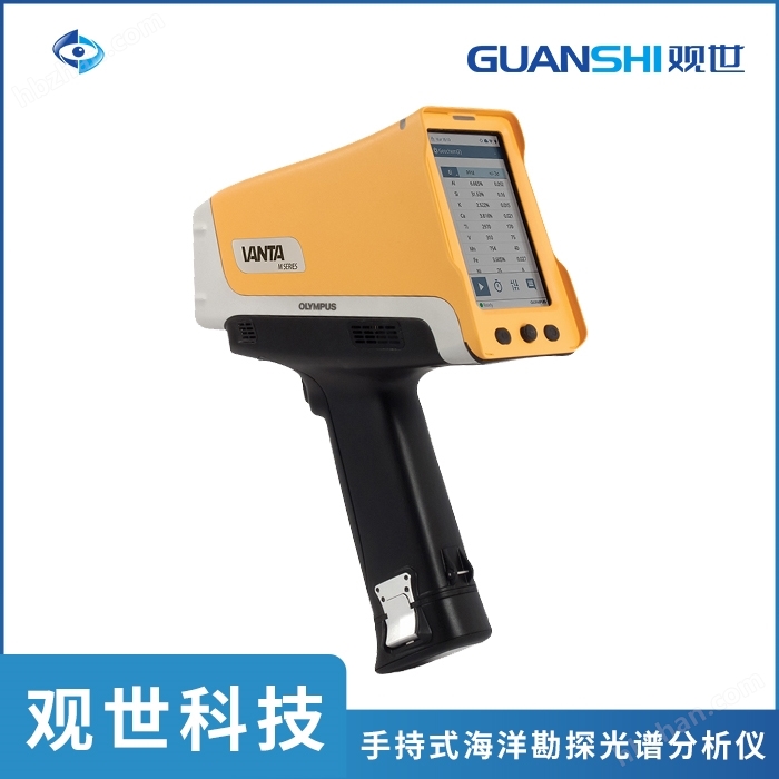


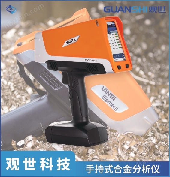
Handheld ocean exploration spectrometer and portable fluorescence analyzer
NegotiableUpdate on 02/25
- Model
- Nature of the Manufacturer
- Producers
- Product Category
- Place of Origin
Overview
Handheld ocean exploration spectrometer: used to analyze various elements in marine geological structures, seabed rocks, and seabed sediments.
Product Details
Complete X-ray fluorescence geological logging using a portable Vanta analyzer

The portable X-ray fluorescence analyzer has high analytical performance and can provide real-time geochemical data, which helps to quickly determine the multi-element characteristics of soil, rocks, and ores. The significant progress in portable XRF technology has significantly reduced detection time, optimized detection limits, and increased the number of detectable elements. Nowadays, geologists typically use rock geochemical information from Vanta analyzers to identify rock types. The Vanta analyzer can also participate in completing some standard geological logging tasks (such as analyzing soil, drill cuttings, and rock cores), as the Vanta analyzer can provide objective chemical composition data in real-time at the sampling site. Before or during routine visual logging, these data can be used to classify rocks and interpret the causes of rock alteration and mineralization.

The data obtained by Vanta portable analyzer helps identify the type of rock and complete alteration logging.
Complete geological logging using data obtained through a portable XRF analyzer
In geological logging work, geoscientists record the rock types, alteration conditions, structures, constructions, and other characteristics of different samples, including soil, drill cuttings, rocks, and drill cores, through visual observation. Earth scientists generally use logging charts (geological logging) to record observed features or paramagnetic characteristics, including color, particle size, structure, structural orientation, bedding, alteration, qualitative change, and cross cutting.
Geological logging capability is a fundamental skill acquired by geoscientists after years of theoretical research on rock and mineral deposit samples, followed by years of field observation of the geological characteristics of rocks in situ or using drill cuttings samples. Only in this way can earth scientists be qualified to conduct detailed and in-depth field logging work to study the complexity and diversity of geology on a global scale. Therefore, in the mineral exploration industry, people often say, "Geologists who see more rocks are the winners
Portable XRF technology and other analytical techniques are changing the way we conduct modern logging in our daily lives. The technology of real-time transmission of objective logging information to geographic information systems (GIS), geological information management systems (GIMS), and 3D visualization and modeling software packages has revolutionized the mining industry.
Visual logging is subjective
The main problem with visual geological logging is that each earth scientist has their own experience, perspective, and ideas about the rocks they see. If the data obtained by multiple Earth scientists for a specific project is combined together, the situation will become very complicated. Figure 1 illustrates the subjectivity of visual observation, displaying logging data provided by eight geoscientists for the same rock sequence. There are 7 different results in the figure (the 6th or 7th Earth scientist replicated each other's results).

It takes a long time after the completion of the original geological logging to receive experimental data from the laboratory, resulting in a fundamental disconnect between logging observations and geochemical data for cross referencing and verification. And it can also lead to making incorrect or delayed decisions on site (continuing deep drilling or stopping drilling), and putting the entire drilling team on hold or relocating to other areas. The ability to provide almost real-time geochemical data is precisely the important role of portable XRF technology.
There are many advantages to using Vanta portable XRF analyzer for geological logging, and if you also use TERRA portable X-ray diffraction analyzer, you can obtain more advantages:
Objective data from different locations or boreholes can be seamlessly linked together
Helps with the classification and identification of rocks
Can enable geoscientists to link lithological observations with geochemical information
Make timely and effective decisions (stop drilling or continue deep drilling)
Rock geochemical data and intelligent multivariate geochemical data can be used to identify rock units, alteration, structural control, and lithological boundaries
Integrating data into algorithms, and even into machine learning routines, to automate workflows
The quantitative mineralogical data provided by portable XRD technology complements the portable XRF data
Can immediately provide and process data, and plot the data into a graph and display it
Data can be observed online in various places
Portable XRF technology, like other analytical techniques, requires not only the use and proper preparation of samples for appropriate applications, but also quality assurance/quality control, and the use of the same chain of custody as conventional laboratory data storage.

Handheld ocean exploration spectrometer
Applied in fields such as geological exploration, marine exploration, mining surveying, mining, ore sorting, ore grade identification, metal smelting, and environmental monitoring.
Marine mineral exploration
1. During the stages of ocean exploration investigation, plowing, and digging trenches, collect the Earth from the mining area;
2. Chemical data is used to establish mining area models, draw maps, and quickly assist users in making decisions;
3. Quickly track mineralization anomalies on site, effectively locate 'hotspot' areas, and define drilling holes;
4. Objective: To expand the survey boundaries of soil samples;
5. Pre screening samples greatly improves the efficiency of laboratory testing outside the site;
6. When drilling, it is possible to drill hollow RAB、RC 、 Analyze samples such as diamond cores.
Marine ore mining, grade and process control
1. Provide theoretical basis for ore trading and decision-making;
2. Real time screening of drilling samples in open-pit mines has improved efficiency in handling ore/waste materials;
3. On site analysis of ore storage piles helps to quickly allocate and feed materials for factories;
4. Real time analysis of feed, concentrate, and tailings enables real-time adjustment of material dosage within the processing plant;
5. In mining applications, special calibration is usually required for specific samples and matrices;
6. The analyzer can be easily set up and operated using multiple calibration models, ensuring optimal performance in actual detection and analysis processes. Even in challenging analysis of light elements such as magnesium, aluminum, and silicon, accurate data can be obtained.
Marine oil and gas exploration
1. Advanced exploration and drilling;
2. Mud logging;
3. Analysis of Light Elements and Trace Metals Required for Shale Oil and Gas Exploration
Similar Product Recommend